 South Australian Current Regulations
 South Australian Current Regulations
Schedule 2—Operational areas for restricted vessels
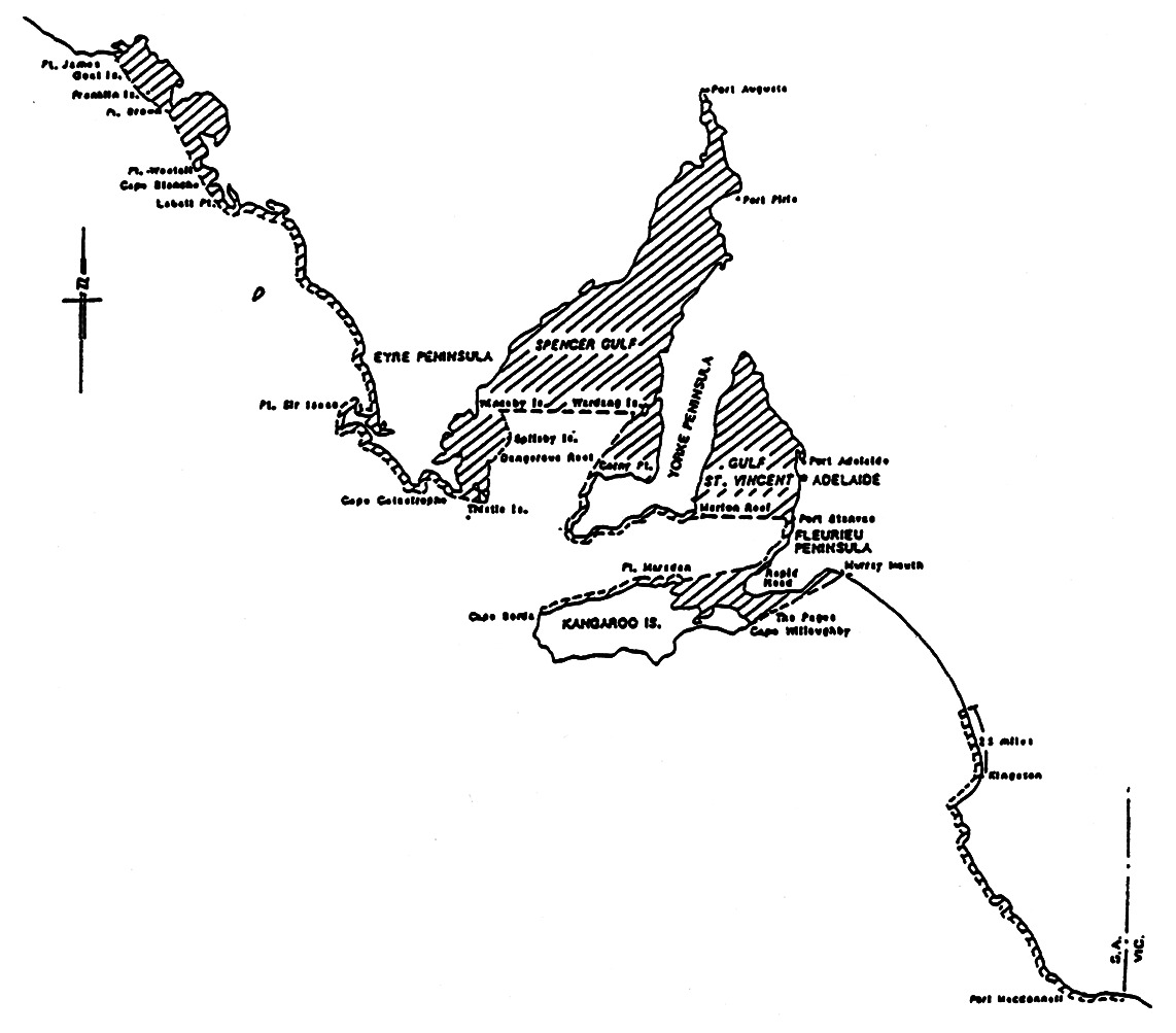
West Coast Eyre
Peninsula Area
All that area of the coastal waters of the west coast of the Eyre Peninsula
lying eastwards of a line from James Point to the south-western extremity of
Goat Island, then to the most southerly point of Franklin Island, then to a
position 3 nautical miles south-west of Brown Point, then to a position
3 nautical miles south-west of Westall Point, then to a position
3 nautical miles south-west of Cape Blanche, then to a position
3 nautical miles south-west of Cape Labatt, then following the coast in a
general south-easterly direction at a distance of 3 nautical miles from
the shore to a position 3 nautical miles south of Cape Catastrophe.
Spencer Gulf and Gulf St. Vincent Area
All that area lying to the north and west of a line from a position
3 nautical miles south of Cape Catastrophe then to Waterhouse Point on
the south-easternmost point of Thistle Island then to the light on Dangerous
Reef then to the easternmost point of Spilsby Island then to Winceby Island
light; and the waters of Spencer Gulf north of a line from Winceby Island
light to a position 3 nautical miles west of Wardang Island; and the
coastal waters east and north of a line from a position 3 nautical miles
west of Wardang Island to a position 3 nautical miles west of Corny Point
then following the coast line at a distance of 3 nautical miles from the
shore of southern Yorke Peninsula terminating at Marion Reef light; and the
waters of Gulf St. Vincent north of a line from Marion Reef light to a
position 3 nautical miles west of Port Stanvac West Cardinal Beacon, and
east of a line from 3 nautical miles west of Port Stanvac West Cardinal
Beacon following the coast at a distance of 3 nautical miles from the
shore to a position 3 nautical miles north of Rapid Head.
Kangaroo Island and Backstairs Passage Area
All that area of Investigator Strait and Backstairs Passage lying east and
south of a line from Cape Borda light to a point 3 nautical miles to the
north, then to a point 3 nautical miles to the north of Cape Cassini, then to
a point 3 nautical miles north-east of Marsden Point light, then to a
point 3 nautical miles north of Rapid Head; and north of a line from Cape
Willoughby light to the southernmost islet of the Pages Group then to the
Murray Mouth.
South East Area
All that area lying to the east of a line commencing at a point on the coast
25 nautical miles north of Kingston projecting seaward for
3 nautical miles, then southward following the coastline at a distance of
3 nautical miles from the shore terminating at the border of South
Australia with Victoria.
The following map is provided for convenience of reference only.
