Tasmanian Numbered Regulations Tasmanian Numbered Regulations
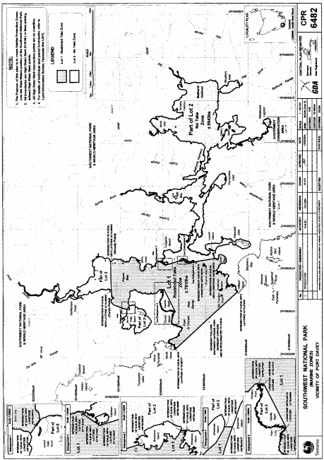
After rule 48 of the Principal Rules , the following Schedules are inserted:SCHEDULE 1 - Kent Group National ParkPART 1 - Restricted take zone for Kent Group National ParkThe restricted take zone for the Kent Group National Park is the area of water comprising approximately 15 048 hectares, shown as Lot 1 with coordinates expressed using Geocentric Datum of Australia and bounded by a heavy black line on Plan 6481 in the Central Plan Register, a reduced copy of which is set out, by way of illustration only, in Part 2 of this Schedule.PART 2 - PlanSCHEDULE 2 - Southwest National ParkPART 1 - Restricted take zone for Southwest National ParkThe restricted take zone for the Southwest National Park is the area of water comprising approximately 7 810 hectares, shown as Lot 1 with coordinates expressed using Geocentric Datum of Australia and bounded by a heavy black line on Plan 6482 in the Central Plan Register, a reduced copy of which is set out, by way of illustration only, in Part 2 of this Schedule.PART 2 - Plan
Displayed and numbered in accordance with the Rules Publication Act 1953 .
Notified in the Gazette on 16 February 2005
These rules are administered in the Department of Primary Industries, Water and Environment.
EXPLANATORY NOTE
(This note is not part of the rule)
These rules amend the Fisheries Rules 1999 by –(a) including two new national parks in the definition of "marine nature reserve"; and(b) allowing restricted fishing to take place in those national parks; and(c) making minor consequential amendments.