 Victorian Current Acts Victorian Current Acts
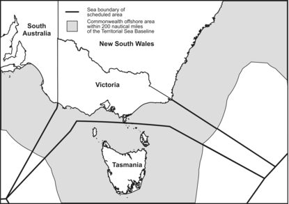
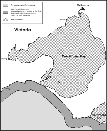
(1) This section sets out simplified maps illustrating areas off the coast of Victoria that are relevant to this Act.
(2) In the interests of simplification—
(a) coastlines and boundaries have been smoothed; and
(b) the maps do not show certain waters within the limits of the State; and
(c) the line marking the outer limits of the coastal waters of the State appears to be further out to sea than it actually is.
(3) The maps illustrate the offshore area, the Commonwealth defined offshore area, and the scheduled area for Victoria.
Note
Generally, the territorial sea baseline is the line of lowest astronomical tide along the coast, but it also encompasses straight lines across bays (bay closing lines), rivers (river closing lines) and between islands, as well as along heavily indented areas of coastline (straight baselines) under certain circumstances.
Part 1.2—Interpretation
Division 1—General